
Boundary survey
Identifies and marks the plot boundary before fencing, compound wall work, construction, dispute resolution or property purchase.
Every land decision needs a different level of detail. Some jobs need boundary clarity, some need record comparison, some need levels, contours or documentation support. Gridworld helps match the method to the risk.
Identifies and marks the plot boundary before fencing, compound wall work, construction, dispute resolution or property purchase.
Supports family property division and inherited land separation with clear plot-wise measurement.
Compares Field Measurement Book records with ground conditions so records, sketches and field realities can be understood together.
Maps ground levels and slope patterns for drainage, foundation planning, retaining walls and site development.
Captures natural and built site features including levels, trees, structures, access, drainage and surface conditions.
Uses satellite-based positioning with corrections for high-accuracy site control and location-sensitive measurement work.
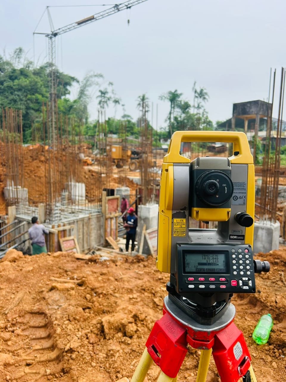
Provides precise electronic distance and angle measurements for boundary marking, construction setout and subdivision work.
Measures elevation and level differences for roads, foundations, drainage and construction planning.
Provides survey inputs and documentation coordination support for land conversion applications. Approval depends on government review and applicable rules.
Helps buyers verify boundaries, records and possible encroachment concerns before committing to a purchase.
Checks plot limits, site levels and usable dimensions before design, permit or foundation work begins.
Prepares accurate existing-site information for design teams, builders and development planning.
Preview examples show the kind of sketches, measurements, and mapping clarity Gridworld can prepare after field verification.
Preview card for survey drawing output, coordinate points and measurement references.
Preview card for survey drawing output, coordinate points and measurement references.
Preview card for survey drawing output, coordinate points and measurement references.
Preview card for survey drawing output, coordinate points and measurement references.
Share why you need the survey and what documents you have. Gridworld will suggest the right scope.